
Loading cart contents...


1858 Antique Map of France – “Carte de France”
Antique Map of France – “Carte de France” (1858)
Engraved map with hand-coloring
- Dimensions: 47 x 34 cm (map only)
- Frame available upon request (+50 EUR)
This exquisite 1858 map of France, engraved by Delamarche, showcases the country meticulously divided into its 86 départements. A product of 19th-century French cartographic expertise, this piece features finely engraved details, delicate hand-colored borders, and elegant calligraphy, making it both historically significant and aesthetically captivating.
The map includes an inset of Corsica, further enhancing its completeness. Its detailed road networks, rivers, and territorial divisions reflect the evolving geography of France in the mid-19th century, making it a valuable piece for historians, collectors, and Francophiles alike.
A perfect addition to any collection, study, or sophisticated interior, this timeless artifact is a wonderful conversation piece and a window into historical France.
📍 Available unframed. Custom framing available upon request.
180 €
1 in stock
Related products


Top rated products
-
 SERGEY IGNATENKO (1975) ''Dreams'' 2016, oil on canvas, 76 x 62cm
2500 €
SERGEY IGNATENKO (1975) ''Dreams'' 2016, oil on canvas, 76 x 62cm
2500 €
-
 Lucien Hector Jonas (1880 - 1947) ''Portrait of Comtesse de Boursaque'', 1905, 90x70
-
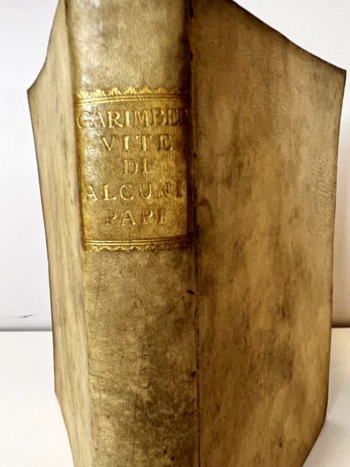 1568 Antique Book Lives of the Popes and Catholic Cardinals by Girolamo Garimberto
1800 €
1568 Antique Book Lives of the Popes and Catholic Cardinals by Girolamo Garimberto
1800 €
-
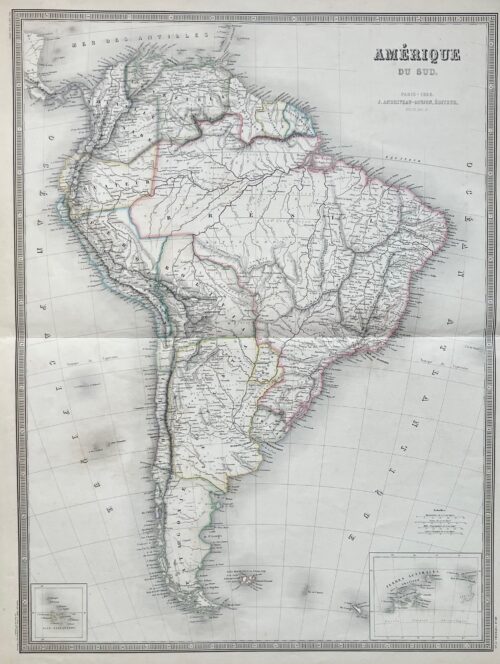 1856 Antique Map of South America – "Amérique du Sud" 68x53 cm
290 €
1856 Antique Map of South America – "Amérique du Sud" 68x53 cm
290 €
-
 EUGENE KORON (1932-2015) ''Nature morte'' 1995, oil on board 82 x 70 cm
2500 €
EUGENE KORON (1932-2015) ''Nature morte'' 1995, oil on board 82 x 70 cm
2500 €
Reviews
There are no reviews yet.